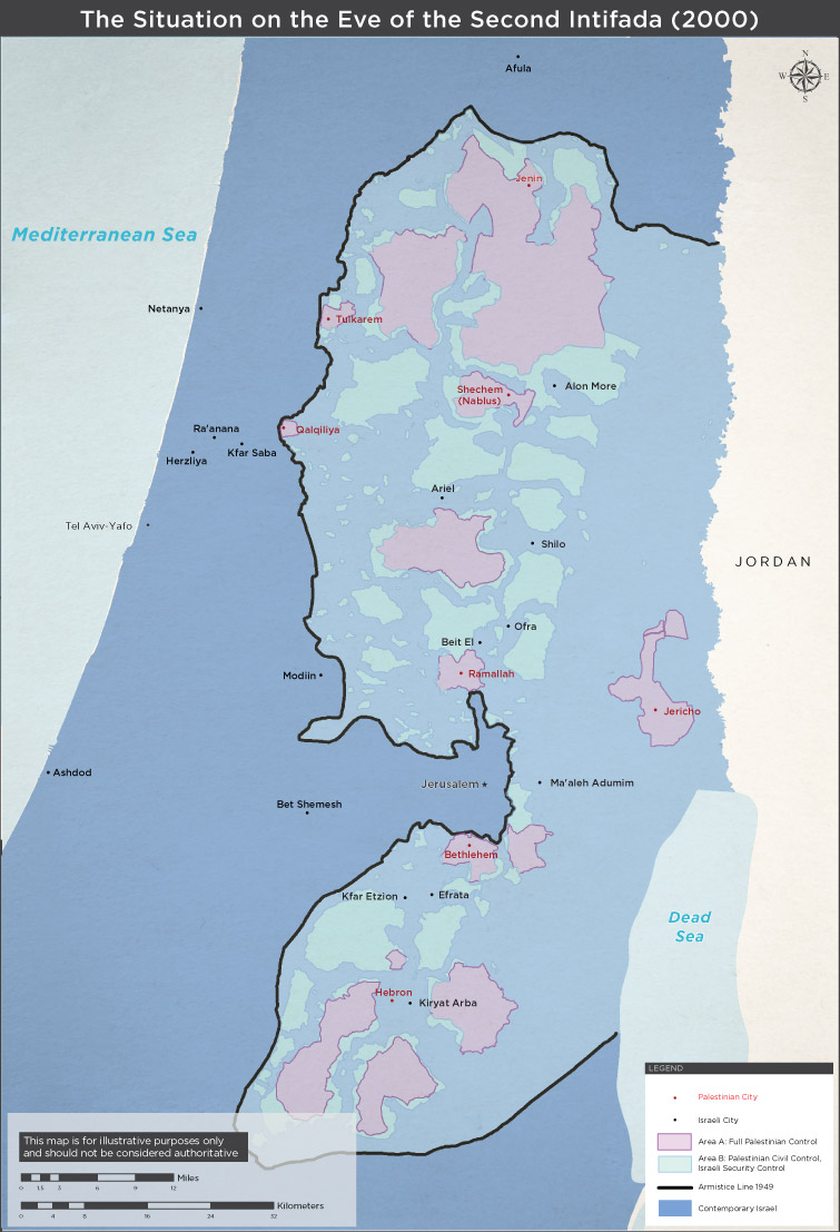
From the Israel Ministry of Foreign Affairs, this map shows which areas were under full Israeli control, which under full Palestinian control (Area A) and which under Palestinian civil control with Israeli security control (Area C) in 2000, on the eve of the Second Intifada. To read an explanation of the map and a brief overview of the Second Intifada, click here.